Casa Grande Photogrammetric Test Range
Why are there giant crosses out in the middle of the Arizona desert?
Around the cities of Casa Grande and Eloy, out in the middle of practically nowhere, there are the remnants of a 16-by-16-mile (26 by 26 km) grid of giant 60 foot (18.2 meters) wide concrete Maltese crosses spaced roughly 1 mile (1.6 km) apart. These are often mistakenly referred to as Corona Satellite Markers but they had nothing to do with the CIA's Corona satellite program. Instead, these markers were used to calibrate aerial photography equipment.
The US Army Map Service (which has changed designation several times over the years but has now morphed into the National Geospatial-Intelligence Agency (NGA)) was instructed to lease parcels of land for "office space" in 100-by-100-foot (30 by 30 m) plots of land. Oh, and there had to be road access. The targets were in use from about the mid-1960s until 1972 when the program ended. In the late 1970s, the targets were considered obsolete because their positions had shifted due to ground subsidence caused by groundwater extraction. At that time, the land owners were given the option of having the markers removed from their land. Even though many markers are missing or damaged, there are also many that are still in great condition.
I recently (April 2026) travelled down to Tucson to see a museum exhibit and took the opportunity to stop off and see one of these targets for myself. Luckily, there is a very handy one right off the I-10. If you're coming from Phoenix then take the exit at Sunland Gin Rd but stay on the freeway access road and start driving back on the freeway. There will be a cross right before the road merges onto the freeway again.
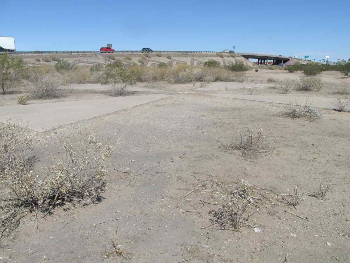
Marker AJ49, just off the I-10 highway in Eloy, AZ
Each cross originally had a survey marker in the middle. This one was a complete cross in good condition, with its survey marker still intact. In case you can't read the writing, here is what's on it
CORPS OF ENGINEERS US ARMY SURVEY MARK - $250 fine or imprisonment for disturbing this marker - AJ 49 2 STATION DESIGNATION YEAR 1967 AGENCY ARMY MAP SERVICES
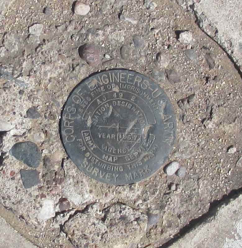
Survey marker
You can't see it in my photo of the cross but they all originally had manholes on them, like this one below. I can't figure out why, though. These are solid targets with nothing underneath. I can't imagine why they would have needed access.
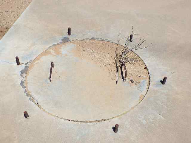
By Marine 69-71 - Own work, CC BY-SA 4.0, Link
- Google map of marker locations - This map shows all targets and classifies them as Present, Damaged or Missing.
- Casa Grande Photogrammetric Test Range (Wikipedia article) - a lot of my information came from this article. Be careful! There are rabbitholes!
- The Space Review: Not necessarily for the NRP: Final thoughts on the Casa Grande crosses - The Space Review is an online publication with in-depth writing on space-related things. There is a persistent rumor that the crosses were actually calibration targets for the Corona spy satellites. One of the writers delves into this topic and puts this rumor to rest. He hopes. Probably not, though. Because, Internet. Fascinating read, though, I highly recommend you take a look!