Arizona Falls

This page is both part of the Off the Beaten Path section of my website and also my entry for the 32-Bit Cafe's 4th Community Code Jam, Vacation Destination. Come and take a little vacation from your daily routine and check out a really cool place, hiding in plain site in the metro Phoenix area!

First, just what exactly is Arizona Falls? The Arizona Canal was constructed in the 1880s. Along the planned route, there is a natural 20 foot drop which the builders elected to keep. In those days, before the advent of air conditioning, this was a place where people used to gather as the mist from the falls provided some cooling relief. In the early part of the 1900s, a hydroelectric station was built over the falls and provided electricity locally until 1950, when it became too costly to maintain. It was rebuilt in 2003, providing up to 750 kilowatts of energy, serving as an educational area and also, as it was in the beginning, a place where people can gather and enjoy a cool respite from the desert heat.
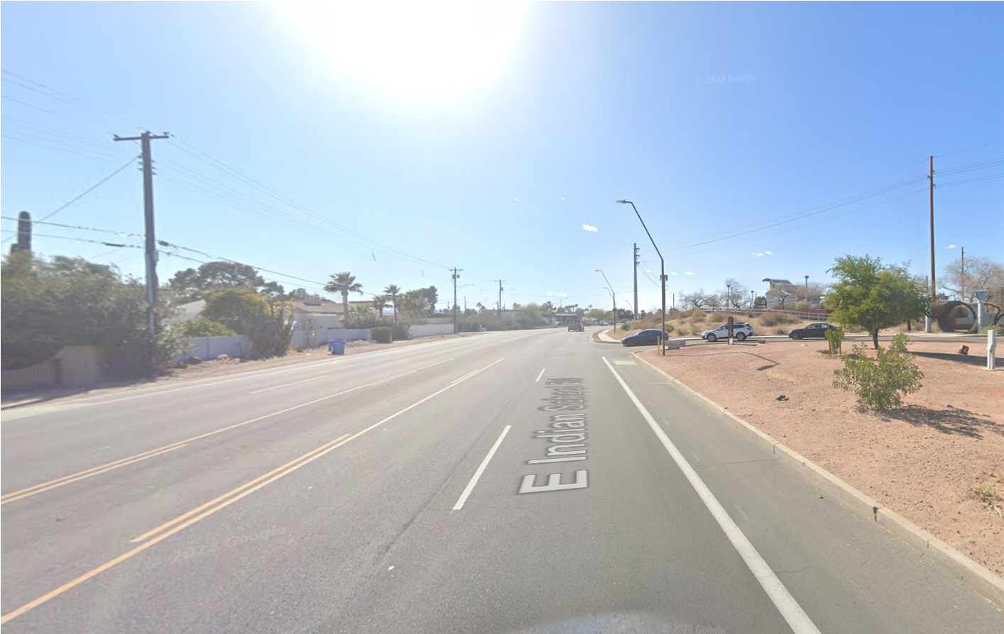
Google Maps screenshot of someone heading west on a city street. On the left are power lines, houses behind white walls, palm trees and other green trees and bushes both inside and outside the walls. On the right is some kind of entrance to a parking lot and there are 3 cars lined up waiting to turn onto the street.
Heading west down Indian School Road, the entrance (to the right) is fairly nondescript and easy to just pass by, if you don't know what you're looking for. I know people who have lived in the area for years and didn't realize Arizona Falls existed.
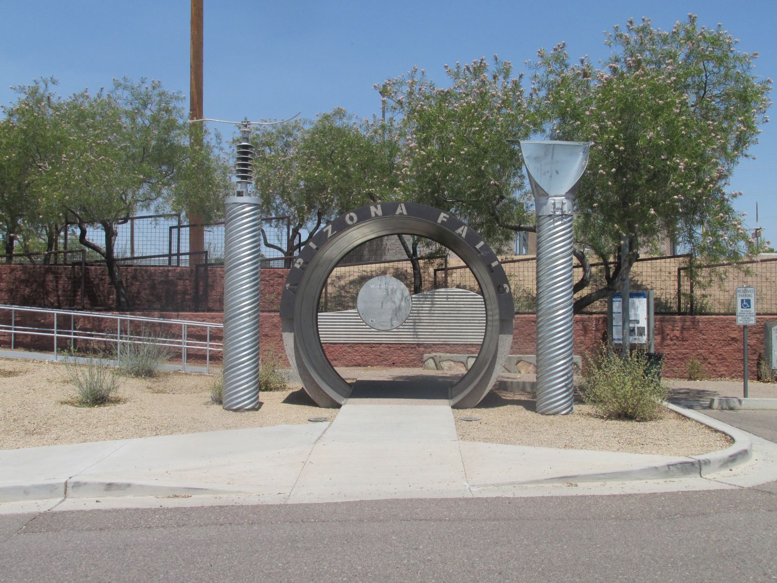
Photo of the entrance to Arizona Falls. To either side of a large, round metal opening there are large metallic sculptures. On the left is a water spigot handle and on the right is a shovel. Through the opening is a pathway that leads upward.
Entrance to Arizona Falls - a section of sewer pipe with sculptures at either side. I believe they are a shovel and a water spigot handle. The walkway heading up leads to the falls.
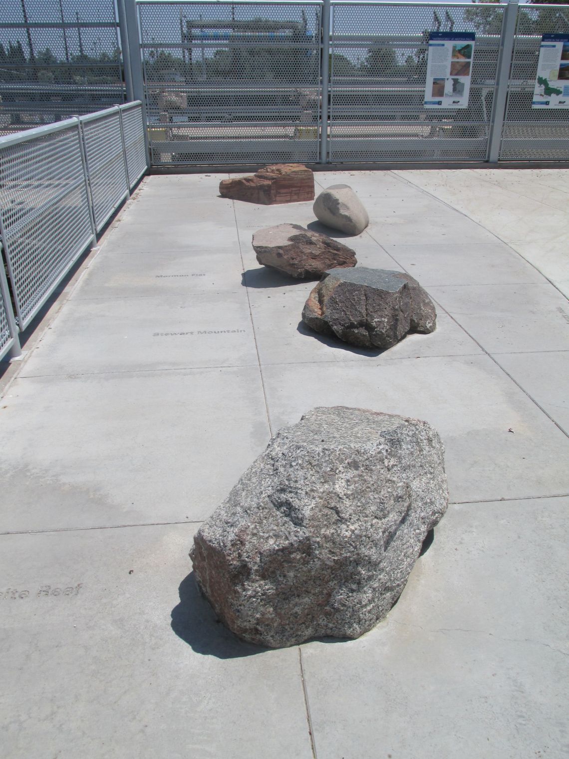
At the top of the walkway is an upper deck that has 5 different boulders, each on representing one of the dam sites along the Salt River. There is fencing around the upper deck area.
Once you climb the walkway, you will find yourself on an upper deck. There are 5 boulders representing the 5 dam sites along the Salt River. All of them are different, showcasing Arizona's wonderful geological diversity. Starting from the top, the boulders are from: Theodore Roosevelt Dam, Horse Mesa Dam, Mormon Flat Dam, Stewart Mountain Dam and Granite Reef Diversion Dam.
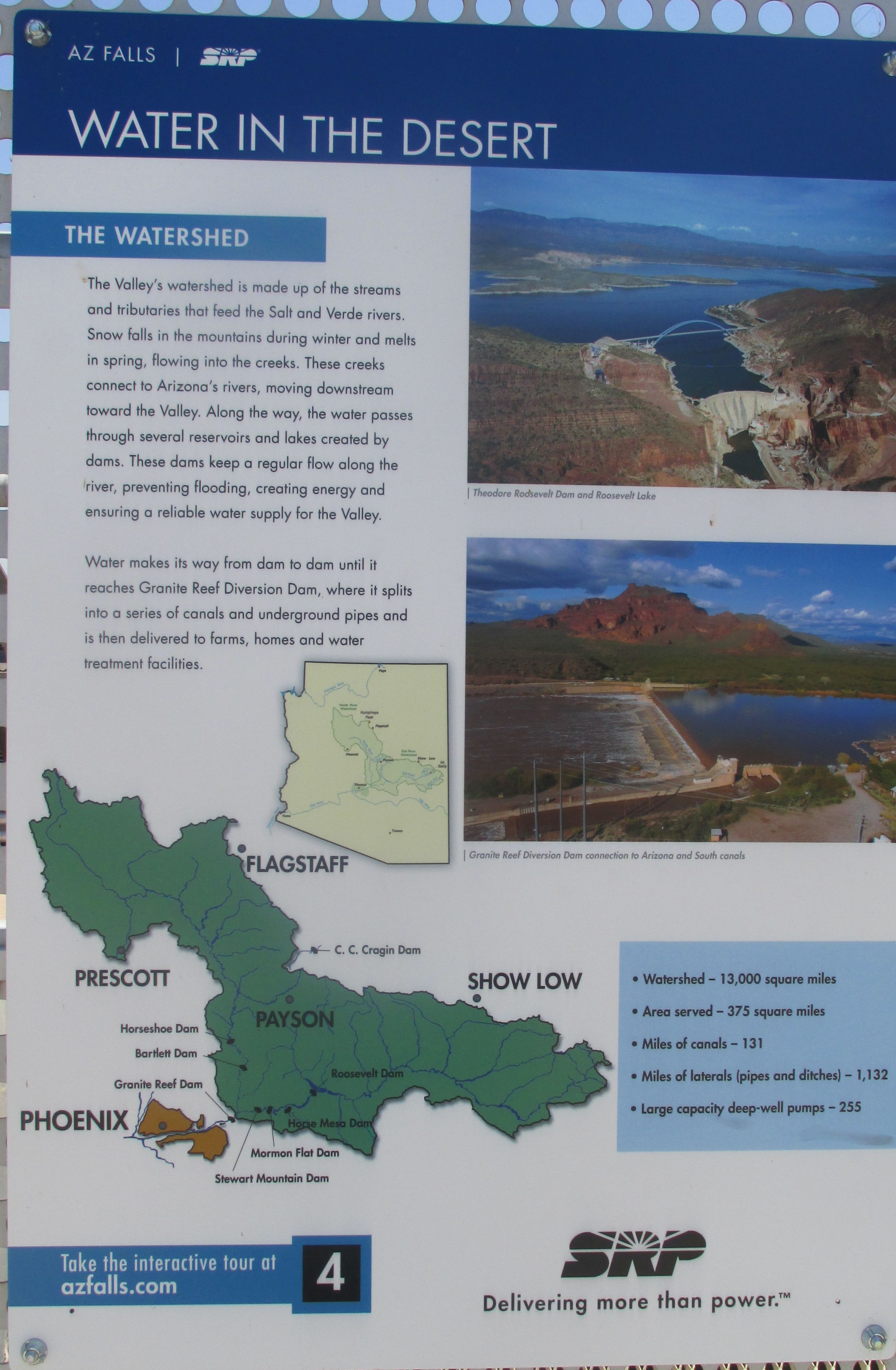
Photo of a sign showing the dam locations and information about the Salt River watershed.
Sign with a map showing the location of the dams and information about the Salt River watershed. There's a link to an interactive tour on the sign. It's a really neat site that explains all about water in the desert and also the history of Arizona's canals.
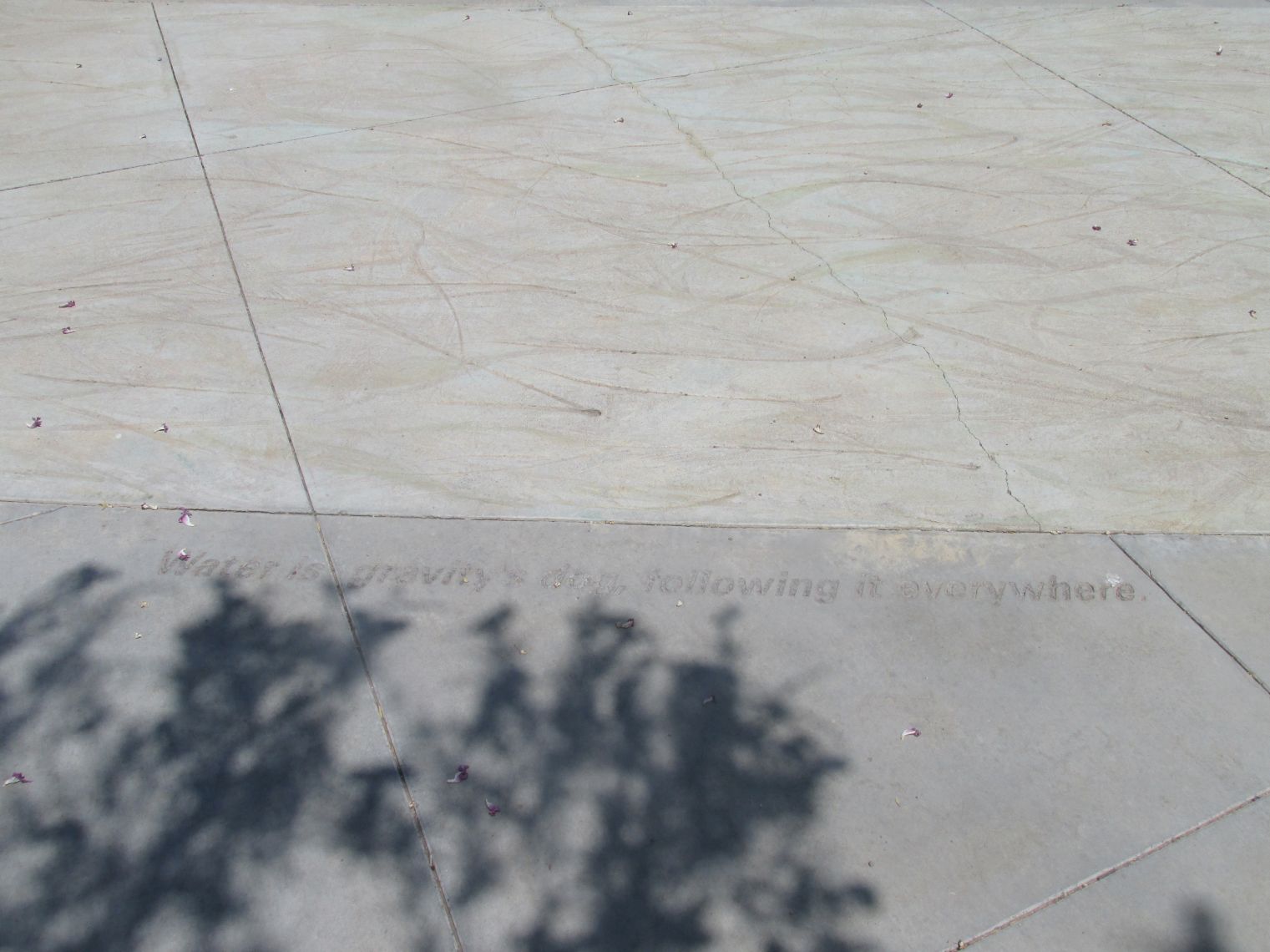
photo of the concrete slabs of the upper deck which have been engraved with images of reeds and acid-stained to mimic flowing water. There is a poem etched into the concrete which reads Water is gravity's dog, following it everywhere.
Arizona Falls is not only a functioning hydroelectric station, it's also a work of art. Part of the deck's concrete has been imprinted with reeds and acid stained to capture the essence of flowing water. There is also poetry inscribed in the concrete! I particularly liked this inscription, which says, "Water is gravity's dog, following it everywhere."
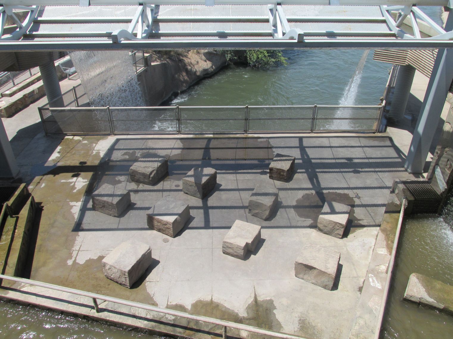
A view from the upper deck looking down on the lower deck. You can see the canal, water sheeting off structures on either side to make a waterfall into the canal, and a seating area with square blocks of stone spread about to sit on. The deck flooring is wet in spots.
From the upper deck area, you can look down into the lower area. There is rock seating and curtains of water everywhere, providing a cooling mist and a lovely natural soundtrack of falling water.
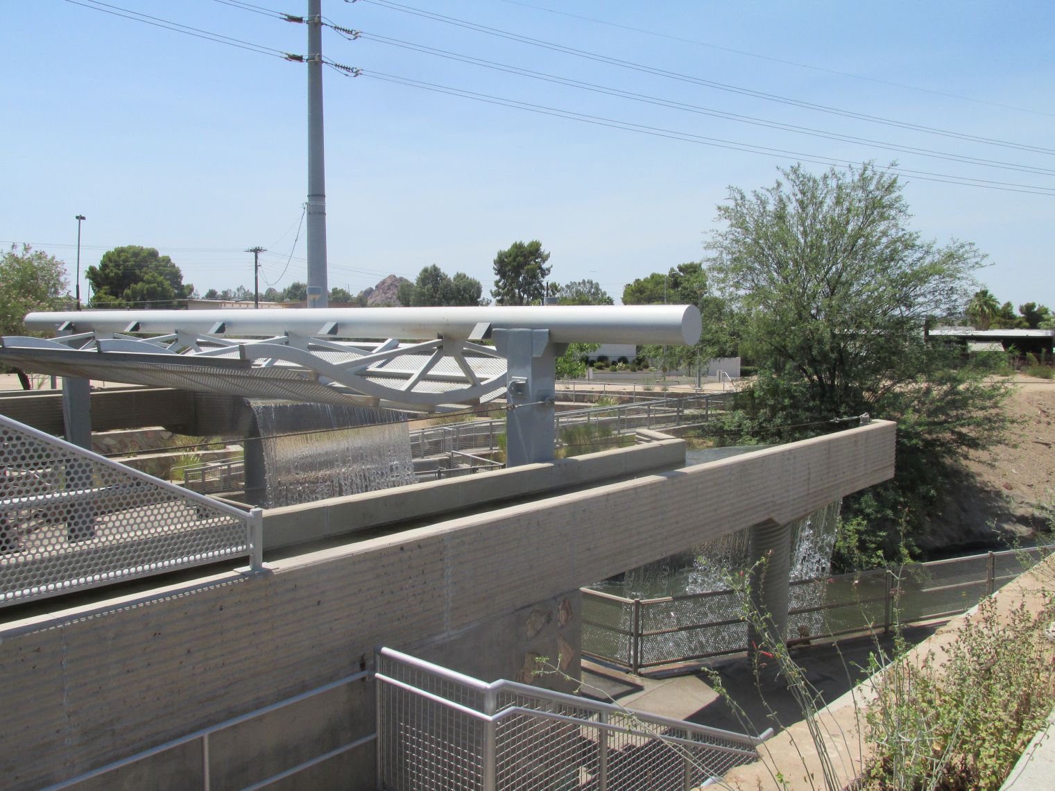
view of an upper section of the structure from where the water comes sheeting down as a waterfall.
Another look at the upper section of the Falls, before heading down to the seating area.
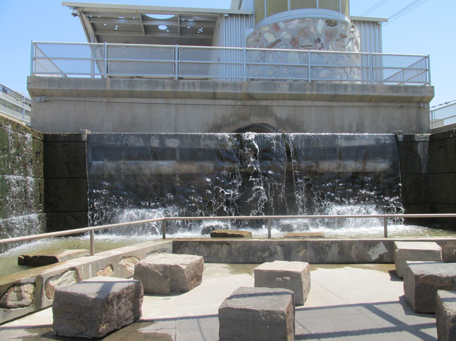
View of the seating area looking towards the upper deck. Right under the upper deck area is a stone wall with water continuously falling in a large sheet and making splashes due to the boulders in the water area. You can see the large square stone seating spread around the lower deck.
You've made it down to the seating area!
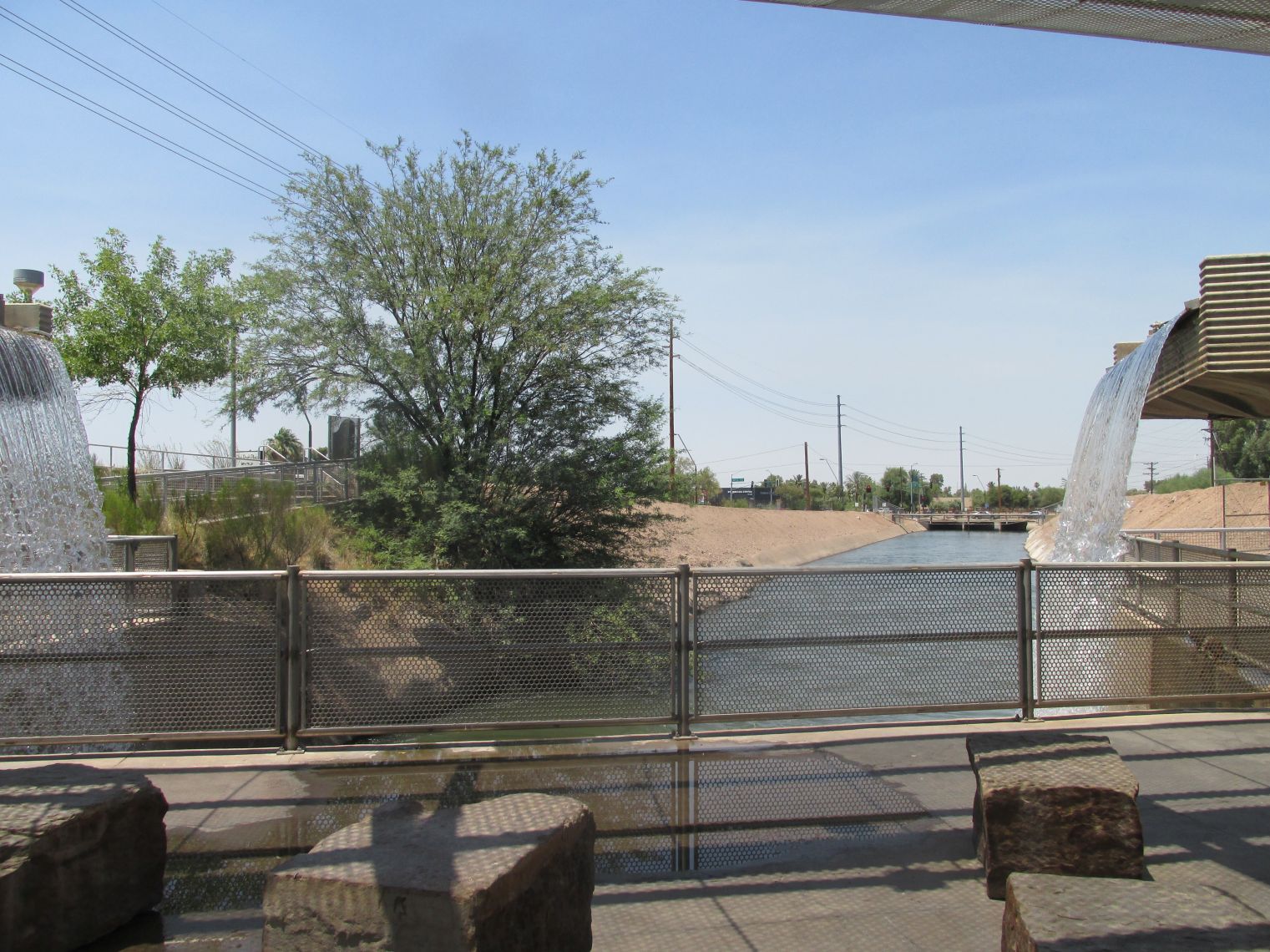
looking down the canal from the seating area. There is a fence to keep you from falling in the canal and on either side are the upper structures with the water coming down like a waterfall.
Looking down the canal.
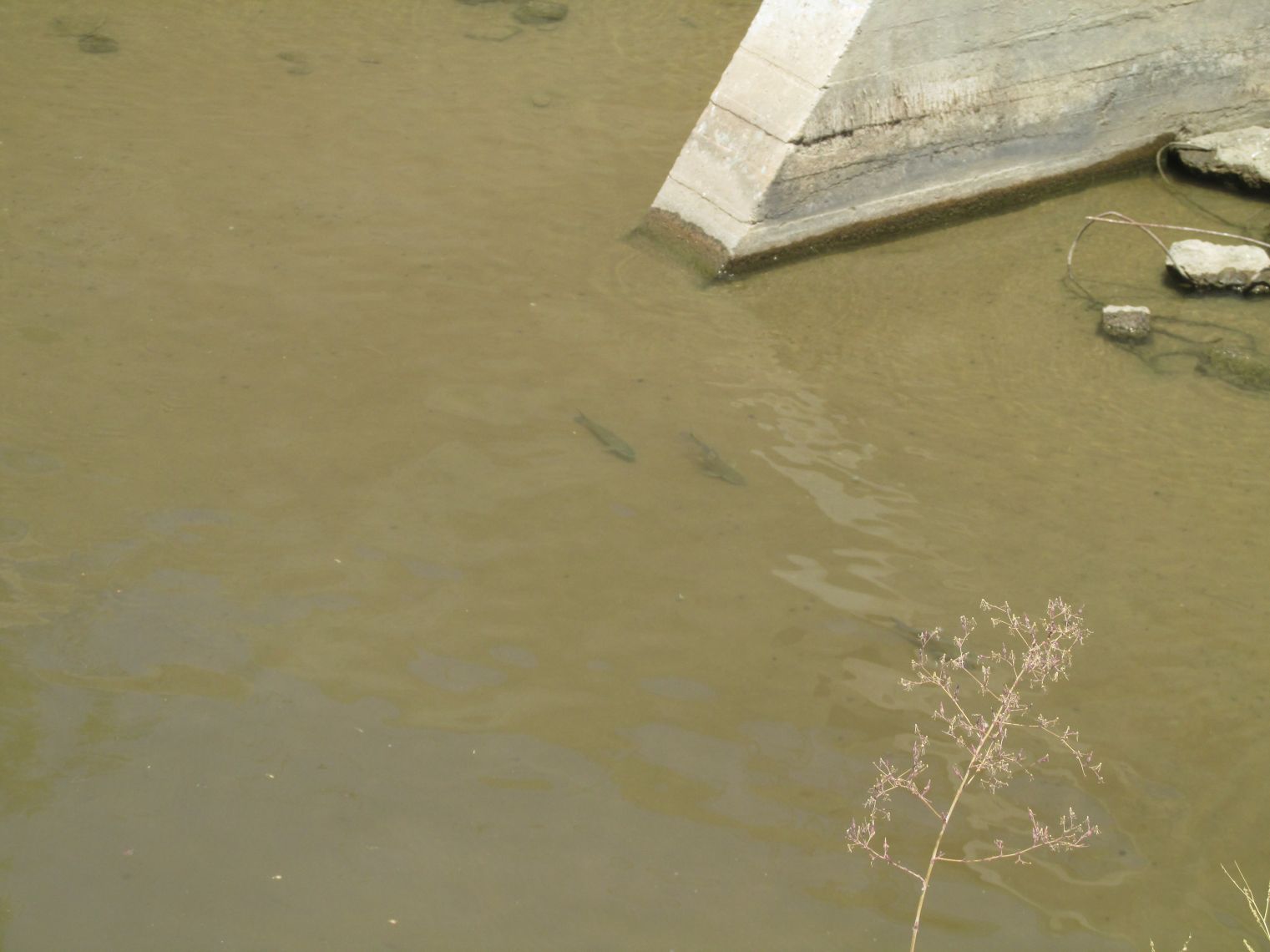
Looking into the waters of the canal, you can see there are fish in there. These are white amur which Salt River Project, who manages the canals, use to keep the canals free of vegetation.
If you look down into the waters of the canal, you might see some fish. But these aren't ordinary fish! These are White Amur and they are used to keep the canals free of vegetation. SRP uses approximately 50,000 White Amur throughout the canal system.

I hope you've enjoyed your time here at the Falls, stepping away from your normal routine for just a bit and having an opportunity to explore a small wonder. I also hope that maybe you are encouraged to seek out hidden places in your own backyard. Don't forget your stamp for the 32-Bit Cafe Destination Vacation Passport!

Blue graphic that looks like a passport stamp. Inside a frame of double ovals with incomplete lines is ARIZONA FALLS with a line underneath.

I'll leave some more links about Arizona Falls for you to check out. If you've been to other parts of Off the Beaten Path, you will find that I have a bit of a thing for infrastructure. If you also have a thing for infrastructure, make sure you visit the links that go to the individual dams. Lots of really cool information to be found there!